Home
Books
Exploring Atlases and Maps Resources
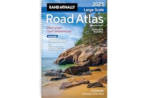
1
Spiral-bound for easy handling and use.
35% larger maps than standard atlas versions.
Covers United States, Canada, and Mexico.
Includes detailed inset maps of 375 cities.
Features 28 national parks for exploration.
Comprehensive, unabridged index for quick reference.
Road construction contacts on map pages included.
Average Rating out of 5:
Price Range: $26.99
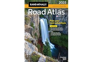
2
Includes up-to-date road maps for all 50 states.
Detailed maps of Canada, Mexico, and Puerto Rico.
Major cities and attractions highlighted with inset maps.
Top 100 adventure destinations and 24 National Parks.
Contact information for local tourism offices provided.
Durable spiral binding for easy, lay-flat reading.
Travel Tough plastic cover ensures long-lasting use.
Average Rating out of 5:
Price Range: $26.96
3
Updated 2025 midsize easy-to-read atlas.
Large print maps for easy navigation.
Convenient travel size fits in glove box.
Inset maps for over 50 North American cities.
Mileage and Driving Times Map included.
Spiral binding allows easy page opening.
Tips for year-round mountain retreats included.
Average Rating out of 5:
Price Range: $17.99
4
Includes up-to-date maps for all 50 states.
Detailed maps for Canada, Mexico, and Puerto Rico.
Features 20 scenic drives for unforgettable trips.
In-depth maps of major cities and attractions.
Comprehensive index and mileage charts included.
Convenient letter-size format for easy storage.
Printed in North America for quality assurance.
Average Rating out of 5:
Price Range: $13.46
5
Easy-to-read cartography for clear navigation.
Shows all Interstate and U.S. highways.
Indicates cities, points of interest, and airports.
Includes mileage chart for trip planning.
Features driving times map for efficient travel.
Displays national facts and symbols for education.
Compact size; folds out for easy use.
Average Rating out of 5:
Price Range: $9.69
6
Trusted road travel tool for over 100 years.
Updated maps of all U.S. states and Canada.
Detailed city maps and national park insets included.
Mileage and driving time map for easy planning.
Year-round mountain retreat recommendations and tips.
State-by-state guide to must-try regional foods.
Tourism contacts for every U.S. state and province.
Average Rating out of 5:
Price Range: $22.49
7
Explore world history through detailed maps.
140 maps illustrating key historical events.
Easy-to-read text panels enhance understanding.
Stunning visuals and informative timelines included.
Published with the Smithsonian Institution's collaboration.
Perfect gift for history and map enthusiasts.
Guided tour through significant historical periods.
Average Rating out of 5:
Price Range: $28.00
Color: 48 positive
8
Comprehensive guide to 63 U.S. national parks.
Includes a full 2025 Rand McNally Road Atlas.
Features stunning photos of each national park.
Detailed maps for easy navigation and planning.
Visitor information on attractions and accommodations.
Updated construction information for all states.
Made in the USA for quality assurance.
Average Rating out of 5:
Price Range: $31.49
9
Waterproof and durable for outdoor adventures.
Tear-resistant material for lasting use.
Detailed coverage of the Northeast USA.
Includes major cities and natural landmarks.
Perfect for road trips and travel planning.
Map scale: 1:1,300,000 for precise navigation.
Compact folded size for easy portability.
Average Rating out of 5:
Price Range: $13.46
10
Waterproof and tear-resistant for durability.
Detailed and accurate information for travelers.
Includes cities, towns, and roads index.
Features recreational and cultural destinations.
Covers Republic of Ireland and Northern Ireland.
Map scale: 1:385,000 for precise navigation.
Compact size for easy carrying and storage.
Average Rating out of 5:
Price Range: $13.90
11
Waterproof and tear-resistant synthetic paper
User-friendly index for easy navigation
Detailed road network with distance indicators
Highlights UNESCO World Heritage Sites and attractions
Covers northern and southern Italy comprehensively
Perfect for adventurous travelers and explorers
Durable design withstands international travel challenges
Average Rating out of 5:
Price Range: $13.46
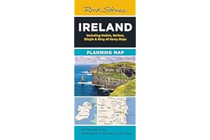
12
Colorful, easy-to-use Ireland travel map.
Highlights Rick’s favorite travel destinations.
Includes detailed maps of Dublin and Belfast.
Printed on durable, tearproof paper.
Features highways, ferry routes, and bus stops.
Easy navigation for travelers and tourists.
Guidebook-friendly layout for quick reference.
Average Rating out of 5:
Price Range: $9.99
13
Waterproof and tear-resistant material for durability.
Detailed road network for easy navigation.
Includes cultural and historical destinations.
Specialty content for recreational activities.
Inset maps for Orkney and Shetland Islands.
Foldable design for convenient travel.
Map scale of 1:440,000 for accurate representation.
Average Rating out of 5:
Price Range: $13.90
14
Waterproof and tear-resistant for durability.
Detailed road network with distances and destinations.
Includes recreational and cultural points of interest.
Features shaded relief for easy navigation.
Perfect for adventure travelers exploring Iceland.
Compact size for convenience on the go.
Map scale of 1:465,000 for accuracy.
Average Rating out of 5:
Price Range: $13.90
15
Laminated and waterproof for durability.
Highly legible scale: 1:12,500.
Includes attractions, hotels, and Metro information.
Pocket-sized for convenient travel.
3-D building illustrations enhance navigation.
Updated twice a year for accuracy.
Average Rating out of 5:
Price Range: $10.86
16
Stunning large-format illustrated atlas of national parks.
200+ visuals: maps and breathtaking park photos.
Perfect for trip planning or armchair exploration.
Covers all 61 national parks across America.
Detailed maps and graphics highlight unique features.
Includes captivating storytelling about parks and ecosystems.
Ideal gift for nature lovers and park enthusiasts.
Average Rating out of 5:
Price Range: $30.82
17
Waterproof and tear-resistant for durability.
Detailed coverage of Arizona and New Mexico.
Includes major national parks and monuments.
Features urban areas like Phoenix and Santa Fe.
Ideal for outdoor adventures and road trips.
Printed on durable synthetic paper for longevity.
Map scale of 1:1,300,000 for accuracy.
Average Rating out of 5:
Price Range: $13.46
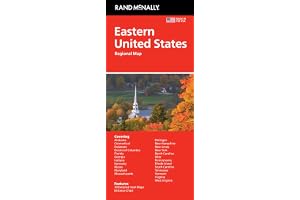
18
Trusted Rand McNally cartography for accuracy.
Detailed maps of major Eastern cities.
Clearly labeled highways and points of interest.
Conveniently folded size for easy transport.
Regularly updated for reliable navigation.
Includes mileage chart and driving times.
Comprehensive coverage of 18 states.
Average Rating out of 5:
Price Range: $9.29
19
Waterproof and tear-resistant for durability.
Detailed coverage of Japan's main islands.
Includes inset maps for Okinawa and Ryukyu Islands.
Highlights cultural and historical points of interest.
Clear index for easy city and town navigation.
Comprehensive road network with distance information.
Printed on durable synthetic paper for travel resilience.
Average Rating out of 5:
Price Range: $11.80
20
Over 300 maps and charts included.
Illuminates biblical geographical contexts effectively.
Perfect for beginners studying the Bible.
Easy to carry for personal or group use.
Enhances understanding of biblical events and places.
Includes detailed accounts of key biblical journeys.
Valuable resource for years of exploration.
Average Rating out of 5:
Price Range: $7.81
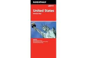
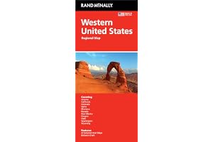
21
Trusted Rand McNally cartography for accuracy.
Features Western United States travel coverage.
Includes major highways and detailed city maps.
Clearly indicated points of interest and airports.
Conveniently folded size for easy storage.
Regularly updated for current travel information.
Easy-to-use legend and detailed index included.
Average Rating out of 5:
Price Range: $9.29
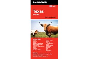
22
Easy-to-read, full-color state map.
40% larger map with bigger type size.
Includes interstate, U.S., and state highways.
Highlights parks, points of interest, and airports.
Convenient folded size for easy travel.
Detailed index for quick location finding.
Regularly updated for accuracy and reliability.
Average Rating out of 5:
Price Range: $11.99
23
Waterproof for reliable use in all weather.
Tear-resistant for durability during travel.
Detailed city map with key attractions highlighted.
Multi-language legend for easy navigation.
Includes metro and train stations information.
User-friendly index of streets and points of interest.
Perfect companion to National Geographic's Paris Traveler Guide.
Average Rating out of 5:
Price Range: $9.95
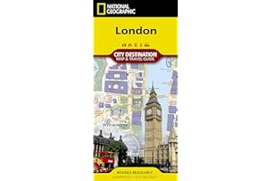
24
Waterproof and tear-resistant design for durability.
Comprehensive city map and travel guide.
Includes 3D depictions of top attractions.
Easy-to-read road map on reverse side.
Pinpoints underground stops and rail stations.
User-friendly index of streets and hotels.
Detailed inset map of Hyde Park and Kensington.
Average Rating out of 5:
Price Range: $9.25
25
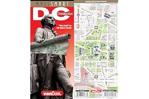
Detailed street map of Washington DC.
Laminated, pocket-sized for easy travel.
3-D building illustrations for enhanced navigation.
Includes Metro system and Beltway map.
Updated twice a year for accuracy.
Collectible graphic art design on the cover.
Average Rating out of 5:
Price Range: $8.95
26
Waterproof and tear-resistant for durability.
Detailed map for adventure travelers.
Easy-to-read index for quick navigation.
Clearly marked roads with kilometer distances.
Covers diverse recreational and cultural destinations.
Printed on tough synthetic paper.
Map scale of 1:825,000 for accuracy.
Average Rating out of 5:
Price Range: $13.90
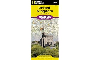
27
Waterproof and tear-resistant for durability.
Detailed road network with distances and designations.
Features UNESCO World Heritage Sites for exploration.
User-friendly index for easy navigation.
Includes major roads and ferry routes.
Covers northern and southern extents of Europe.
Printed on durable synthetic paper for travel resilience.
Average Rating out of 5:
Price Range: $13.90
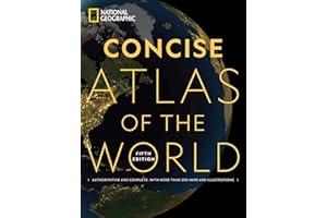
28
More than 250 detailed maps and illustrations.
Comprehensive coverage of political and physical geography.
Expert data on continents, countries, and regions.
Visualize current issues like health and economics.
Special section on space, moon, and Mars.
Large-format pages for enhanced detail and readability.
Durable softcover design for long-lasting use.
Average Rating out of 5:
Price Range: $19.03
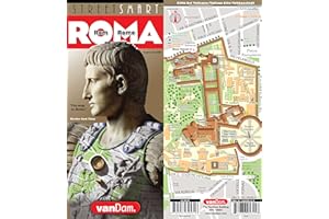
29
Pocket-sized, laminated folding map of Rome.
Clear, legible scale of 1:12,500 for easy navigation.
Includes detailed Vatican map at 1:6,500 scale.
Features self-guided walks to top attractions.
3-D illustrations enhance map clarity and usability.
Perfect for tourists exploring Rome's urban core.
Average Rating out of 5:
Price Range: $10.95
30
Waterproof and tear-resistant for durability.
Perfect for outdoor adventures in the Northwest.
Highlights national parks and outdoor attractions.
Detailed map of Washington, Oregon, and Idaho.
Includes major cities and scenic routes.
Scale of 1:1,300,000 for precise navigation.
Compact size for easy travel and storage.
Average Rating out of 5:
Price Range: $11.80