Home
Books
Children's Educational Atlases for Learning
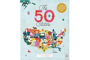
1
Explore 51 charming infographic maps of the USA.
Discover over 2,000 fascinating U.S. facts.
Learn about states from Alabama to Wyoming.
Includes guides to state flags and U.S. presidents.
Find significant dates and events in history.
Inspire your love for America's diverse landscapes.
Perfect for curious minds and adventurous spirits!
Average Rating out of 5:
Price Range: $14.76
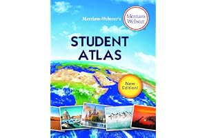
2
Engaging maps designed for middle school students.
Updated with recent global events and statistics.
Features full-color physical and political maps.
Thematic maps cover diverse global topics.
Includes easy-to-read charts and graphs.
Glossary with brief definitions included.
Perfect resource for home and classroom exploration.
Average Rating out of 5:
Price Range: $9.59
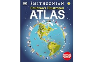
3
Exciting world atlas for children aged 7-9.
More than 50 colorful maps included.
Engaging facts about countries and cultures.
Beautiful illustrations and photographs throughout the book.
World map poster included for easy reference.
Teaches map-reading skills and compass use.
Perfect gift for young geography enthusiasts.
Average Rating out of 5:
Price Range: $16.96
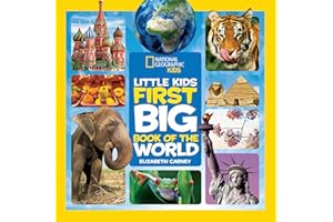
4
Over 50 infographic maps for engaging learning.
Explore geography, animals, and cultures worldwide.
Easy-to-read maps for young explorers.
Over 1,500 fascinating facts about each country.
Highlights God's creation with biblical insights.
Perfect for ages 6 to 10 years old.
Ideal gift for curious young adventurers.
Average Rating out of 5:
Price Range: $13.38
Color: 3 positive
5
Introduces kids to the world’s diversity.
Explores languages, landscapes, and weather.
Features captivating animals and capital cities.
Encourages hands-on activities for engagement.
Over 100 colorful photos enhance learning.
Kid-friendly maps simplify geographical concepts.
Perfect for storytime or bedtime reading.
Average Rating out of 5:
Price Range: $10.46
Color: 10 positive
6
Ideal for kids ages 6-10
Detailed maps of all seven continents
New map on global migration included
Engaging graphics with fun facts
Stunning photography showcases world diversity
Perfect for geography classes or home learning
Complements other National Geographic atlases
Average Rating out of 5:
Price Range: $10.19
Color: 9 positive
7
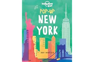
Vibrant pop-up book about New York City.
Features six stunning pop-up illustrations.
Introduces iconic landmarks to young explorers.
Includes Empire State Building and Statue of Liberty.
Perfect for children aged 5-12 years.
Encourages curiosity and love for travel.
Also available: Pop-up London and Pop-up Paris.
Average Rating out of 5:
Price Range: $8.79
8
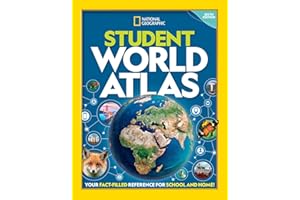
Award-winning Student World Atlas for global citizens.
User-friendly content with stunning visuals and maps.
Includes new thematic maps for every continent.
Updated infographics, statistics, and maps included.
Ideal for classroom, college prep, or home use.
Engages middle and high school students effectively.
Explore important global topics and issues seamlessly.
Average Rating out of 5:
Price Range: $8.47
9
2025 edition with updated flags and maps.
Engaging design for children's learning experience.
Includes local flags of dependent territories.
Concise, clear information for easy understanding.
A perfect gift for curious children.
Chapters on continents, countries, and capitals.
Ideal for school homework and projects.
Average Rating out of 5:
Price Range: $10.99
Color: 9 positive
10
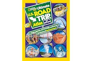
Colorful maps for engaging road trip navigation.
22 new games enhance travel entertainment for kids.
Fun facts keep kids informed during journeys.
Vibrant pictures showcase wacky signs and monuments.
Easy-to-read layout suitable for young explorers.
Updated content offers new attractions and activities.
Perfect companion for family road adventures.
Average Rating out of 5:
Price Range: $9.29
11
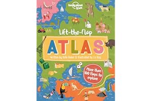
Interactive atlas with 100+ lift-the-flap features.
Explores continents through colorful illustrations and fun facts.
Written by Kate Baker, illustrated by Liz Kay.
Discover unique cultures and wildlife around the world.
Engaging educational experience for young readers.
Encourages curiosity about global geography and history.
Promotes exploration and adventure for families together.
Average Rating out of 5:
Price Range: $13.99
12
Join Angry Birds on a global adventure.
Explore continents, countries, and diverse cultures.
Engaging activities make learning geography fun.
Develop observation and analysis skills effectively.
Exciting egg hunt motivates exploration and discovery.
Perfect for young adventurers and curious minds.
Transform learning into an exciting journey.
Average Rating out of 5:
Price Range: $9.99
Color: 3 positive
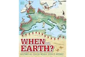
13
Stunning 3D maps illustrate world history.
Engaging journey from ancient times to present.
Over 60 detailed global and regional maps.
Explore key historical events and civilizations.
Perfect for curious children aged 9+.
Unique visual storytelling for educators and parents.
An ideal gift for young history enthusiasts.
Average Rating out of 5:
Price Range: $13.61
14
Engaging introduction to 13 global cultures.
Perfect for ages 5 to 8, Teachers' Pick.
Beautiful illustrations create a welcoming atmosphere.
Explore geography, customs, and languages worldwide.
Interactive format highlights similarities and differences.
Updated edition enhances a bestselling classic.
Encourages curiosity about global cultures and lifestyles.
Average Rating out of 5:
Price Range: $7.89
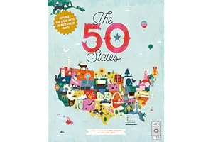
15
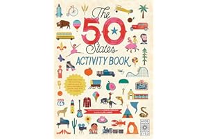
Explore all 50 states of the USA.
Illustrated infographic maps for visual learning.
Discover over 2,000 fascinating facts.
Includes state flags and US presidents guide.
Features inspiring people from each state.
Encourages outdoor exploration of national parks.
Perfect for young explorers and curious minds.
Average Rating out of 5:
Price Range: $11.53
16
Updated seventh edition for kids' learning.
More than 75 detailed National Geographic maps.
Over 350 vibrant color images included.
State-specific maps with key facts and highlights.
Physical maps show diverse U.S. landscapes.
Carefully researched for accuracy and reliability.
Ideal reference for school and family use.
Average Rating out of 5:
Price Range: $8.44
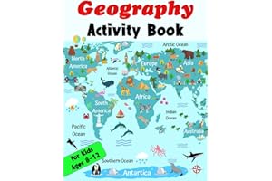
17
Engaging activities that entertain and educate.
Explore continents, landmarks, and landforms.
Promotes creativity and critical thinking skills.
Perfect for curious learners ages 8-12.
Convenient solutions provided for all activities.
Ideal gift for young explorers and adventurers.
Inspires a lifelong love for geography.
Average Rating out of 5:
Price Range: $8.99
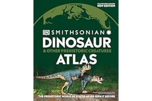
18
Explore 40+ dinosaurs from around the world.
Detailed maps reveal fossil sites and locations.
Connects dinosaurs to Triassic, Jurassic, and Cretaceous periods.
Stunning visuals bring prehistoric creatures to life.
Perfect for kids aged 9 and up.
Includes latest discoveries in dinosaur science.
Ideal for school projects and fun learning.
Average Rating out of 5:
Price Range: $15.97
19
Over 75 detailed 3D maps of the world.
Engaging content on geography, nature, and history.
Discover fascinating places and unique phenomena.
Inspires curiosity about the world around us.
Perfect for school projects and educational fun.
Fact panels provide additional information and statistics.
Captivating visuals make learning enjoyable for kids.
Average Rating out of 5:
Price Range: $10.78
20
Engaging beginner atlas for preschoolers.
Colorful maps spark children's curiosity.
Learn basic geography concepts easily.
Distinguishes between globe and map.
Interactive questions enhance learning experience.
Reviewed by geography and education experts.
Perfect for junior explorers' first adventure.
Average Rating out of 5:
Price Range: $13.47
21
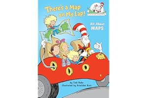
Engaging rhymes by Dr. Seuss.
Introduces maps and geography concepts.
Features beloved Cat in the Hat character.
Perfect for story time and early readers.
Includes index and glossary for learning.
Encourages exploration and discovery of maps.
Part of the Cat in the Hat's Learning Library.
Average Rating out of 5:
Price Range: $9.63
22
Explore maps of all 50 states.
Engaging trivia and word puzzles included.
Creative drawing and matching exercises.
Imagine your own unique state prompts.
Double-sided fold-out map for easy reference.
Over 50 fun stickers to collect.
Perfect for travel or at-home fun.
Average Rating out of 5:
Price Range: $7.67
23
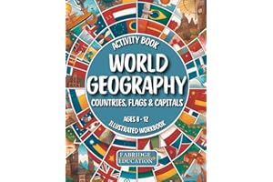
Explore countries, capitals, and flags worldwide.
Engaging activities like puzzles and quizzes.
Colorful illustrations to captivate young learners.
Perfect for kids aged 8–12 years.
Encourages independent learning with answer key.
Ideal for home or classroom use.
Builds geography knowledge in a fun way.
Average Rating out of 5:
Price Range: $16.49
24
Trusted companion for Bible students of all ages.
Nearly 100,000 copies in print.
Beautifully redesigned layout with new maps.
Covers Old and New Testament journeys.
Includes index of place names for easy reference.
Features major archaeology sites of the Middle East.
Invaluable Bible companion for students and learners.
Average Rating out of 5:
Price Range: $10.35
25
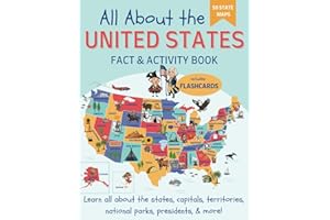
Engaging activities for learning U.S. geography.
Colorful maps of all 50 states included.
Fun facts about U.S. presidents and government.
Flashcards for state capitals and abbreviations.
Word searches and quizzes for interactive learning.
Perfect for homeschool or supplementary education.
Includes national parks and landmarks information.
Average Rating out of 5:
Price Range: $9.99
26
Engaging introduction to world geography for kids.
Features colorful photos and kid-friendly maps.
Explores languages, landscapes, and weather phenomena.
Encourages hands-on activities for interactive learning.
Age-appropriate facts about each continent included.
Perfect for storytime, bedtime, or anytime reading.
Promotes curiosity and exploration of the world.
Average Rating out of 5:
Price Range: $8.99
Color: 10 positive
27
Explore 25 official Disney and Pixar maps.
Discover iconic locations from beloved animated films.
Perfect for fans of all ages and nostalgia.
Includes maps from classics and modern favorites.
Engaging stories retold alongside captivating illustrations.
A magical journey through Disney's enchanting worlds.
Great gift for Disney enthusiasts and collectors.
Average Rating out of 5:
Price Range: $28.18
28
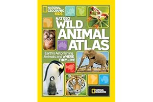
Engaging animal photos and vibrant maps.
Teaches geography through fascinating wildlife.
Spotlight on regional animals worldwide.
Thematic spreads on habitats and endangered species.
Ideal for home and school learning.
Captivating facts for curious young minds.
Encourages exploration and discovery of nature.
Average Rating out of 5:
Price Range: $11.63
Color: 8 positive
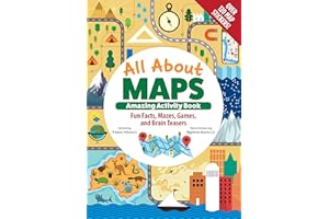
29
Interactive activity book for kids ages 8-12.
Learn how to read and interpret maps.
Includes fun facts about cartography and maps.
Challenging mazes, games, and brain teasers.
Colorful stickers and cut-out materials included.
Build a working compass like a geographer.
Exciting exploration of geography through engaging activities.
Average Rating out of 5:
Price Range: $12.99
30
Fully updated seventh edition for kids.
Features over 75 detailed National Geographic maps.
Includes 350+ vibrant color images.
Each state has easy-to-read, detailed maps.
Brief essays with essential state facts included.
Physical maps showcase America’s diverse landscapes.
Carefully researched for accurate, up-to-date information.
Average Rating out of 5:
Price Range: $13.60